Saturday, 3 August 2013

Day 10 Whitehorse to Dawson City, Yukon Territory, Canada

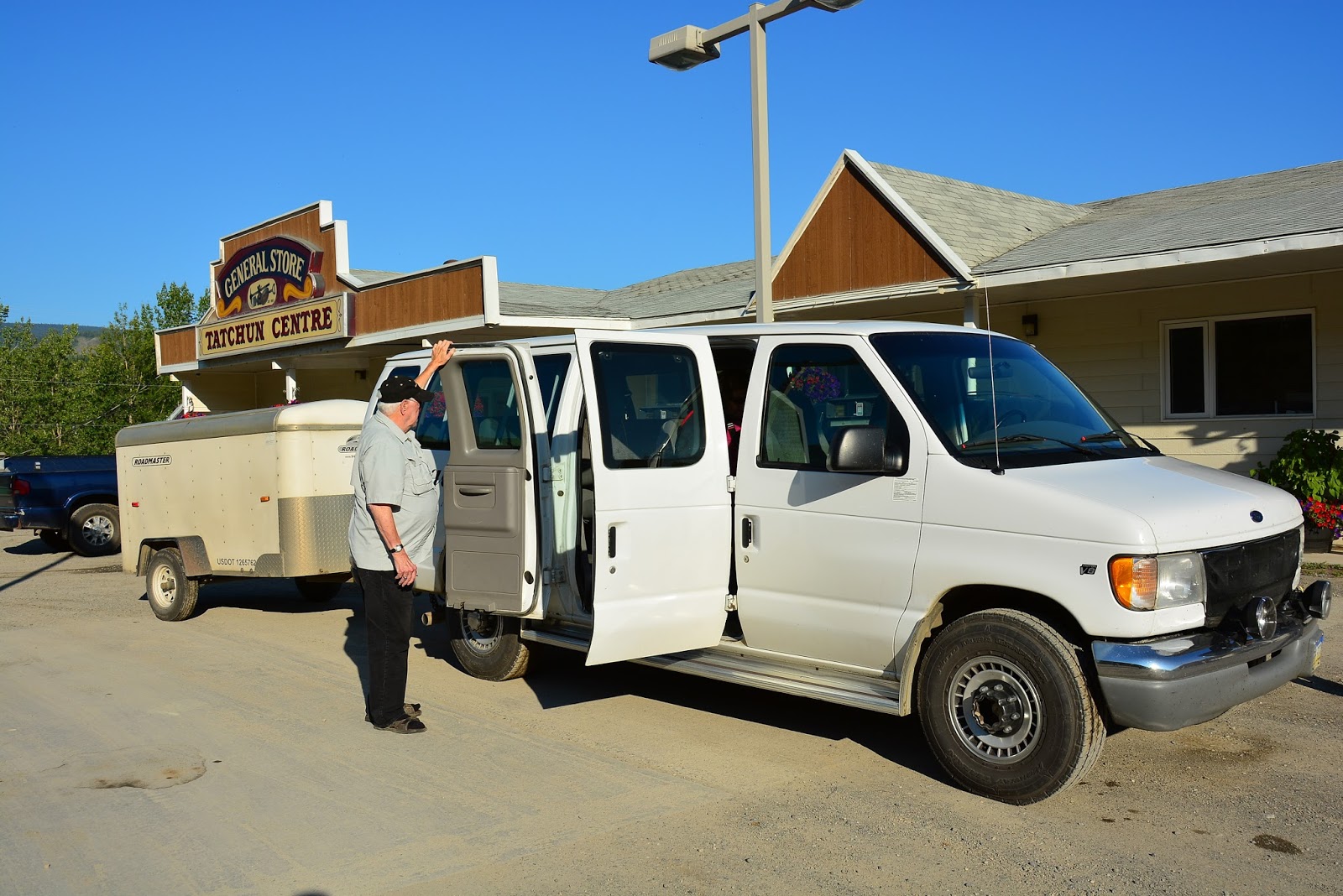
As retired people, we were happy to have an easier day today. Under blue skies we loaded into our touring van for day: a 12 seater Ford which may have been 12 years old and had 300,000 miles on the clock but it looked good, was very comfortable and made good time. Our driver was Dan and he lives in Fairbanks so he was able to tell us all about the area through which we were passing. He was a lovely man with years of experience. When we first met him we were worried about his shaking hands but after spending 500 kms on the North Klondike Highway with him during which time everything in the car and the trailer vibrated due to the uneven surface of the road as it breaks up due to the permafrost, we understand that 25 years of those conditions would make anyone shake.
 The hotel in which we had spent night was opposite the start/finish line for the Yukon Quest which is a 1000 mile dog sled race which goes between Whitehorse and Dawson City and return. Petrol in Whitehorse (Canada) is $1.39 per litre so it is a bit cheaper than we have to pay.
Our trip began in an area of very rich soil in which canola, barley, carrots, lettuce, turnips and potatoes were planted. However, as the rainfall is only about 11 inches per year, irrigation is used to produce the crops. From there we entered the Tahini Trench which runs for 900 miles from Dawson City to Watsons Lake. It was formed when a chain of volcanoes blew up simultaneously. The forces from the explosion led to the huge tectonic movement which caused the Yukon River to flow backwards and huge deposits of gold to form. The only volcano which did not explode is now Mt Logan, the highest mountain in the NW of Canada.
We saw many spruce covered hills but there were some with different trees and tall, thin trunks of former trees. Apparently, when there is a fire, spruce trees take more than a generation to regrow because the soil is not acidic enough for them. Therefore birch and willows have the upper hand. The Trench (long, long valley) is filled with beautiful, deep, long lakes. Eg Fox Lake is 26 miles long and 730ft deep; Lake Testa is 800 miles long and Lake Laberge is 28 miles long. The surface of Lake Fox was so calm that there were mirror images of the scenery in the water. The Yukon River is 2,300 miles long
Suddenly, Dan stopped in the middle of the highway. Standing in front of us were 2 elks. The father had already crossed the road and was waited in the trees at the side of the road but the mother stood fast and eyed us until her baby had crossed the road before she then joined her family. Fantastic!!! We were so close to the animals.

We saw B-doubles carrying silver and copper from the mine at Minto. Each load earns the mine $800,000 and they take 5 loads a day to Skagway. Gold is hauled in special containers because of the cyanide factor. Perhaps we will have to organise one tomorrow night after we have been to the goldmine. I’m sure they will give out samples…lol. The Bogo mine is the second largest gold mine in the USA. Last month it mined 5,000 pounds of gold …wow!!
Neil asked Dan about some orange boxes we could see beside the road. They are gifts from Bill Gates. He has run computer cables all through Alaska and now has started to do it in the Yukon. He has provided optic fibre cable for all schools (and a computer for each child) and for all medical centres so remote doctors can link up with those in big hospitals (eg in Seattle) to keep doctors and nurses up to date with research and techniques.
We saw an interesting sign beside the highway: “Caution: Watch for Aircraft”. The reason the sign is there is because planes land on the highway in that area….an interesting prospect!!
We came upon roadworks on a bridge and there was a set of mobile traffic lights with an interesting twist..there was a countdown in seconds (142 seconds to 0 and a green light). The next set we came across was even better…we had to wait up to 10 mins for a pilot car to take us through to the other side . The pilot car was just going back and forth all day.
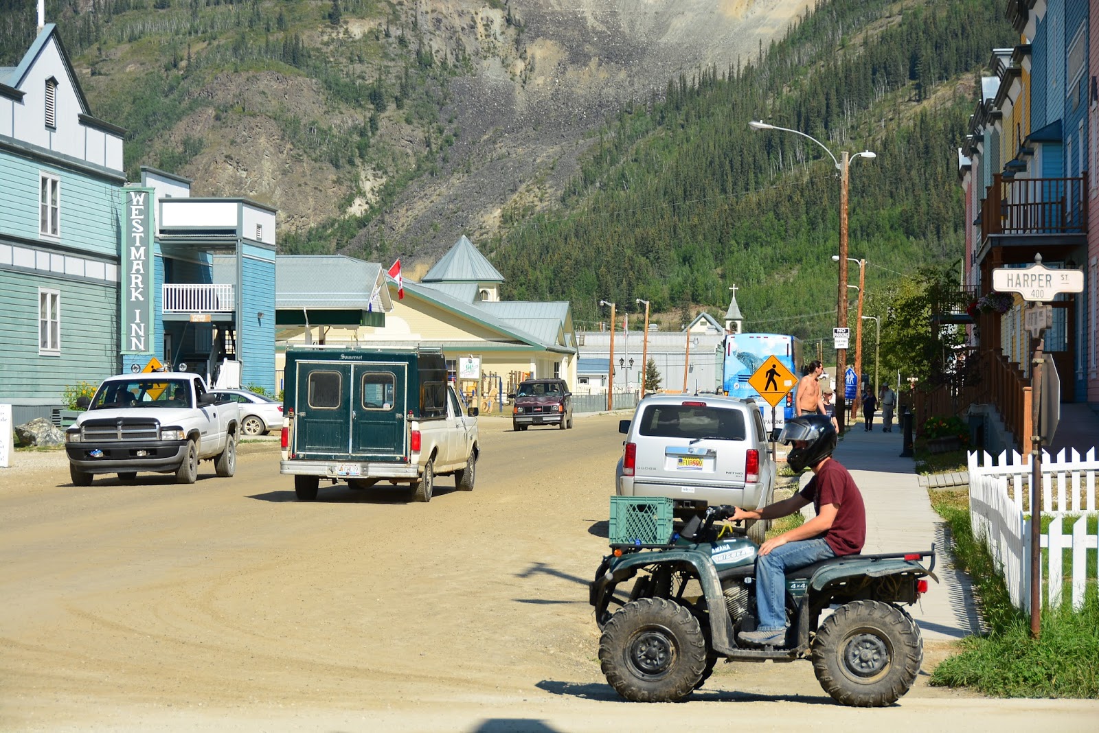
By the end of the drive we understood the vastness of the land, the pristine wilderness and the power of the tributaries which join the majestic Yukon River. There were also the animals: the elks, the squirrels and the grouse who all crossed the road. Moose and Brown Bears also live here but they were probably hiding from the heat. We arrived in Dawson City (64* N) and the temperature today was 32*C. We are only about 200 kms from the Arctic Circle!!

We hope it is a bit cooler tomorrow for our gold expedition but in the old days up to 30,000 men worked in the neat so we should be right for 3 hours. I’ll let you know how we get on with our very own gold rush. 

Thursday, 1 August 2013

Day 9 Skagway to Whitehorse through Carcoss

After a quick breakfast of cereal and orange juice (fantastic for a change), we said goodbye to Sgt Preston staff and their 2 dogs and walked the four blocks to the White Pass and Yukon train station. We had all of our luggage and we had a few stops on the way for Neil to stand in the middle of the road and take photos.

It was okay because the cruise ships from yesterday were gone and the first 2 ships for today had not released their passengers so it was pretty hard to find anyone around at 6.30 in the morning. I sat with the gear beside the carriages of the historic train and noted that the carriages were named after rivers and lakes in the area it travelled. It is a narrow gauge railroad with ironwork at the end of each carriage. At 7am the conductor went through and unlocked all the carriage doors and put the steps down for the passengers. The office staff arrived on their push bikes and things were starting to roll. Neil came back from taking photos and went to confirm our reservations and then we were amazed. Because we were going on to Whitehorse and not doing a loop run, we had to catch the same kind of train but it was about a mile away at the rail yards where they stored all the rolling stock. I was all set to get on the train I had been sitting next to but we had to catch a bus (provided by the railroad) to the other train. On the bus we went right passed Sgt Preston’s hotel (maybe we should have waited there)
No problems!! The train was exactly the same as the other one. It must get cold on these trains at the end of the season (May- Sept), because there was a pot belly heater in each carriage. The railroad from Skagway to Carcross was built over 100 years ago and stretches for 67.5 miles. There is an engineer, a brakeman and a conductor to drive the train and we had a fantastic tour guide called Halley who told us about every aspect of the track/history/scenery.  She went through the general housekeeping rules and made an interesting comment: All children and husbands must be accompanied by a responsible adult at all times because men are like children around trains!! She warned that if anyone smoked, the staff would assume they were on fire and would act appropriately to douse the flames. It was going to be fun.
We saw the Klondike goldrush cemetery. People mainly died due to gun fights rather than illness. However over 3000 horses died due to overwork and poor care routines by their owners. The scenery all day was fantastic. The skies were blue, the  Rivers had icy blue water and often flowed over rapids. Looking back we could see a panoramic view of Denver Valley, Skagway, the harbour and the ice capped mountains, On many occasions, we had sheer drops of hundreds of metres on the left side of the track and huge, rocky  or spruce covered green mountains on the right so the track was built on a narrow ledge around the mountains. 2000 men worked on the line to build it and 35 workers died. Two of them are remembered with crosses where they were crushed to death by a huge falling rock.
Fireweed was abundant along the banks of the rivers and lakes. It has a pretty purple flower but it blooms from the bottom up so the last blooms are at the top and when they die off they form a white cotton like mass. It is said that once that happens it will snow in 6 weeks time. It is called fireweed because it is the first to return after a fire. After Slippery Rock we crossed a famous wooden bridge on the side of a mountain as we climbed the 3.9 per cent grade. Then we entered a tunnel in the side of the mountain. Mountain goats were grazing on the side of the steep mountains.
We saw the retired steel cantilever bridge which has been listed as an Historic Engineering Landmark in the same way that the Eiffel Tower and the Panama Canal are and entered a 600 metre long tunnel called “opportunity tunnel”……The White Pass elevation is 2888ft and there are many snow capped peaks in the area. The land there is rising by 2-3 inches per year. Alaska has more glaciers than any other country in the world except Iceland and many of them are not named but they are spectacular.

White Pass is where the border between Canada and the USA is so we stopped at the next settlement, Fraser British Columbia to go through Customs. The officers just entered each carriage and checked our passports. They stopped all cars and did the same but they never looked in caravans or the backs of RVs. Strange, don’t you think? The vegetation changed to aspen trees and blueberry bushes near Lake Bernard. There were fantastic reflections in the water of the rock formations closest to the lake and the huge mountains in the background.

At Lake Bennett we stopped for a lovely lunch of meat casserole, coleslaw and apple and pear pie. There was coffee or water to drink but no tea but the water was very refreshing as it was quite a warm day and, yes, the skies were blue!!1. Apparently, the area in which we had lunch is covered by 30-40 ft of snow in winter and the huge lake freezes. One fellow took advantage of the cold and started selling hot food to the stampeders (those going to the gold rush). Then he opened a hotel and gradually his fortune grew. His name was Frederick Trump: Donald Trumps Grandfather.

After a delightful day looking at beautiful scenery and experiencing the historic railroad, we arrived in the small town of  Carcross  and after a 2 hour break in which Neil explained our tourist attractions in Australia to an American couple who were very interested and then he found out that the man behind the counter at the railroad office was from Tasmania. He talks to everyone!!! We took a highway bus to Whitehorse. On the way we passed the world’s smallest desert and Emerald Lake which certainly lived up to its name.

Day 8 Gustavus to Skagway - Flight over the Glacier Field

Last night at dinner we sat next to a couple from Sterling Alaska. From Gustavus they fly to Haines and then drive 18 hours over 2 days to get home (home is a 20 by 14 ft cabin. They are going to build an ecofriendly house with a basement and 2 upper floors when they have saved enough money ( 2 years time) and they intend to live there forever. They have 2 acres backing on to the Kenai Wildlife Reserve ( 2 million acres). The only problem is that they have to be careful when going to the toilet because they often cross bear tracks between their cabin and the outhouse. They also have to have all their food for the winter stockpiled. They eat fish and moose and have that frozen but they spent some of their time at Glacier Bay collecting berries to take home for the winter. Originally they came from Texas and Vermont so they have made a deliberate decision to live in the remote area of Alaska. The fellow flies to the oil fields for work: 2 weeks on and 2 weeks off and she works for a mining company which lets her work similar hours so they have 2 weeks off each month. It was very interesting listening to their stories.

This morning the sky was grey for the first time on our trip but it didn’t last very long. We were lucky that our tour of the Bay had been yesterday because this morning you could not see any of the snow capped mountains. They were lost in the clouds but I think that today’s Bay travellers would have seen them later after the clouds lifted. Given that we were booked on the 6 seater plane again today to get to Skagway, we were more concerned about reduced visibility and the probability of arriving safe and sound. At breakfast, a very helpful waitress tried to help other guests plan their day and suggested they go on a hike to the famous plane wreck nearby. Apparently you can write your name on it. I hope they are careful because the rogue bear was seen on one of the hiking tracks yesterday.
Stu drove us back to the airport and once again gave us lots of information about the area. He is of Hoona Tlingit descent and lives in the area. Neil asked him about weapons. In Alaska you can carry weapons, even concealed ones. One day he and his wife came face to face with a black bear. He scared the bear by firing a shot between the bear’s toes but he was going to fire the next shot between the bear’s eyes if the bear  didn’t get the message and leave. The only other option would be to be macho and take on the bear to protect his wife but that could have ended very badly. Perhaps he could have let his wife take on the bear but he felt that in all fairness he would have had to warn the bear that his wife can kick, scratch and fight like hell!!! The bear would have been in big trouble. Luckily the bear left.
We arrived at Gustavus airport and when our plane arrived we were very very happy. It was a 10 seater and the newest plane in the fleet AND there were steps to board the plane. YES!!!!! We took off through the light clouds and at first flew between 2 sets of snow capped mountains. It looked like the mountains were floating on cotton wool. The ones on the left of the plane were higher and had more snow on them. The highest peak there was Mt Fairweather which we had seen from the boat the day before. The view from the plane all the way to Skagway was fantastic, beautiful, incredible and majestic. I’ll try to describe it but it will be difficult. We flew over mountains with snowfields in cirques and beautiful ming blue lakes in small cup-shaped gouged holes. At lower altitudes after the cloud cleared, we could see trees, grass and waterways meandering through the valleys but the tops of the peaks were rock and snow. As far as you could see on both sides of the plane, there were rocky snow-capped mountains waiting for the next winter snow falls so lots of small glaciers would flow again.

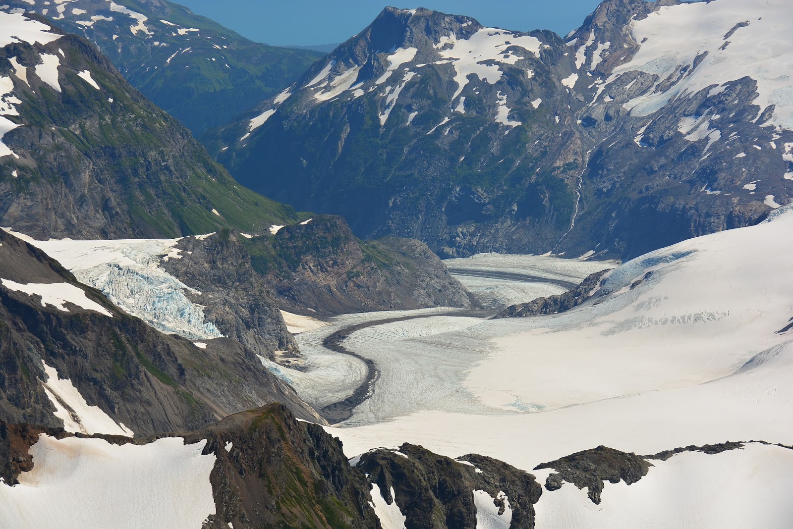
Suddenly we came across a huge field of snow and ice which seemed to join all the mountains together. It was the start of the Davidson Glacier and it descended   U shaped valleys into a beautiful lake/inlet from the inside passage. We saw mountain goats on the sheer rock walls grazing on something above the glacier. Amazing!! The next glacier was smaller and stopped in a suspended hanging valley and entered the water as a waterfall. The pilot was great!! He skilfully tilted the plane at angles so that we could see everything. We flew over Haines airport and marvelled at the pretty aqua water below. The spruce trees grew almost to the edge of the water and a neat border of small rocks gave the water’s edge a clear definition.
We followed the water like a highway and saw 4 cruise ships docked at Skagway. Six helicopters were lined up to take cruise ship passengers up to see the sights we had just seen. We came in for a perfect landing and it was a pity that the flight had to end. It was spectacular and we are very happy that Carol from Alaska Ferry Adventures included this in our tour. In fact every day seems to be better than the day before. Alaska is a hidden gem that more people should hear about and include in trips to America.


Skagway was established in 1898 as a mining town in that miners arrived here by boat and left from here to go to the Klondikes. Many of the streets have been set up to show what the town was like then eg there is a dancing review and before the show girls hang out of the upper windows to invite customers to the next show. The population of Skagway is normally about 800 people but with 10,000 people from 4 cruise ships in town, the streets were very busy. These ships will leave tonight but apparently another 4 ships will dock tomorrow so, it seems, the town relies on tourism and, in Summer, money flows well.

Wednesday, 31 July 2013

Day 7 Boat Trip to Glacier Bay National Park and Glaciers

After a great night’s sleep and a leisurely breakfast (we obviously didn’t tip enough last night), we ambled along a nature walk through a spruce forest with an undergrowth of hemlock, down to the Glacier Bay tour boat (the Baronof Wind). We were early so Neil stopped to get a photo of the Park Ranger who would be with us today. Someone behind asked if she was a ranger to which she replied “No, I just like the colour green” so we knew she had a good sense of humour.

Panic set in when we reached the top of the gangway and we realised that we didn’t have our vouchers. It looked like Neil would be doing a quick sprint back to the Lodge but luckily the boat steward had our names on a list and we were fine. While we waited to depart, we listened to an elder of the Huna Tlingit tribe(Cultural Ambassador) talk about the area. Her tribe had lived in the area from Ketchikan to Glacier Bay for thousands of years. There are many Huna settlements now across the area but there is only one Indian Reservation in Alaska and that is on an island. Glacier Bay is known as Bay in place of the glacier to local people as their ancestors hunted and gathered in the bay area until the glacier suddenly pushed down on top of the lad and then receded leaving a massive area of water. The ranger explained later that as far as research has shown, 500 years ago a mini ice age ended and water built up under the glacier until a point when the ice rushed forward slipping in front of the water and dumping a huge amount of ice in Icy Strait. Therefore that area was not as badly eroded as other areas and is now shallower and provides a good food source for otters, seals, sea lions and whales.

Marylou, our National Park Ranger, then went through a few housekeeping matters like using the life jackets, using handrails while moving around the boat and the need to yell “man overboard” if either males or females fall overboard so that we could pick them up before hypothermia set in. Also there were fantastic binoculars for us to use throughout the day. She gave us some facts about the area as well
·         Glacier Bay is one of the largest protected areas in the world (3.3million acres)
·         In 1780 the glaciers reached the Lodge we were staying in before they started to recede. In 230 years they have receded about 100 miles
·         The flat islands in the first part of the bay were once moraine (dirt dumped by glaciers)
·         It is a humpback whale sanctuary and we saw 2 humpbacks playing on the way back. They were breeching and flapping their tails
·         The whales eat here in summer and then swim to Hawaii for the winter and to have their babies
·         To protect the environment there is a limit on the number of boats that can enter the bay at any one time
·         Sea otters have no fat, a fast metabolism, a thick coat which they fluff up to keep them warm and they eat all the time. We saw many of them relaxing on their backs and having a feed. There are 8-9000 sea otters in Glacier Bay but 20 years ago there were only a few. Only native people can hunt them.
·         South Marble Island is a mecca for wildlife. We saw seals and sea lions sunbaking. (Now I’m not sure whether Chocky is a bear or a sea lion. There are similar in attitude to work in the midday sun). We saw thousands of birds which looked like seagulls. They go to the island to nest. There were many puffin birds (black feathers with a huge orange beak)
·         Just after Muir Inlet which was covered in ice in 1860, we stopped by nosing the boat into the gravel beach to pick up some adventurers and let some off the boat with all their gear. They stay there for up to 2 weeks to be at one with nature but they sure had a lot of supplies. I hope they keep them well away from the bears. They were going to do some research on bear activity so they probably knew all the rules
·         The scale of the setting is very hard to picture. We were in 1400 ft (470 metres) of water and Mt Fairweather which is the tallest mountain in the area is 1500ft (500m) above the surface.
·         Bald Eagles build nests on the trunks of evergreen trees and we saw one in its nest and one flying at eye level past us in the boat
·         Near Gloomy Knob, a river comes down to meet the lake from Mt Merriam so there is lots of activity in the water due to the salmon in the water. We saw mountain goats and a bit further along we saw a mama bear (sow) and 3 cubs down at the water’s edge. As I watched the slowest cub climb up the sand dune after his mother I thought that maybe Chocky is a bear after all. The cub was slow and not at all enthusiastic but mum was keeping a close eye on him. They were brown bears and they had come to the shoreline and the river bank to eat berries and salmon. Bears avoid conflict if they can by trying to intimidate opponents rather than fighting because they know a fight could be fatal. Brown bears can also be black or white!!!
·         We passed Rendue glacier and we noticed icebergs starting to appear in the water
·         Then we saw 2 glaciers which were very close together; Margerie Glacier is made of white ice and is still growing while the Grand Pacific Glacier is rare in that very few glaciers are made of black ice. It is receding.
·         Our main aim had been to reach the John Hopkins Glacier and we knew we were getting closer when the number and size of the icebergs increased. A glacier needs year around snow to grow and the John Hopkins and the Margerie ones both come from the same snowfield which is based in the tallest mountains here. The John Hopkins Glacier has grown 3 miles in the past 40 years. So scientists are now talking about global changes rather than global warming because not all the glaciers are retreating.

·         “No words can describe the beauty of Glacier Bay” according to our guide and that was true of the area around John Hopkins Glacier in particular. We stopped to watch ice crashing from the front of the glacier (it gives a whole new dimension to defrosting the freezer) and there was silence. The engines were off and no-one was talking. Nature was in control.
·         Gilman Glacier was only 100 metres from JHG. We sat between the two. A crew member told us that this was only the third time this year that the boat had been able to go as far as the JHG and that was because of the fantastic weather we had. Yes, it was a perfect blue sky day again
Unfortunately we had to go back but it was relaxing to watch all the scenery again. All of our food and drinks were supplied by the crew and we were totally immersed in the scenery. Then we met Richard. Richard was a member of the Mensa group who were also on the boat and he just wanted to talk. He worked for NASA and had retired. He did not want to watch the scenery but glanced over whenever anyone saw an animal. Luckily we could still watch for animals and listen to any points made by the ranger but we also find it interesting to talk to locals. We talked about travel until he said we had seen more of the USA than he had so then he talked about US television shows which had been screened in Australia. He could only name 3 that we hadn’t seen and he was shocked at the amount of American culture we had been exposed to. We thought the man in front was getting annoyed at the talking but he turned around and waited for a break and in a very deep Texan voice said “What about Bonanza?”.
So Richard decided to crack a couple of jokes:
·         What is the difference between a tourist and a hitchhiker?   Answer: 5 mins
·         What is the difference between ignorance and apathy? Answer: I don’t know and I don’t care
We enjoyed talking with Richard and we seemed to amuse him with our responses but once we docked he said goodbye.
Glacier Bay National Park (World Heritage listed) has to be the highlight of our trip so far and we think it would have to be in the same classification as the Grand Canyon in terms of breathtaking splendour.


Monday, 29 July 2013

Day 6 Juneau to Glacier Bay National Park via Gustavus

We woke up just before the 4am knock on our stateroom door. By 4.30 am we were packed and ready to go as soon as the boat docked at Juneau (capital of Alaska) at 4.45am. While we waited for a taxi, Neil started talking to George from Georgia(67 yrs old). George has run 29 marathons this year, including 2 this last weekend (Saturday in Ketchikan and Sunday in Wrangell. He had his friends set a range of goals eg running a marathon in every state, running a marathon each month and running marathons on consecutive days. He didn’t even seem stiff.
We caught a taxi to Juneau airport with George and his friend but at 5am there was not a lot open. We had tea, coffee and cookies for breakfast under the watchful eye of a 3 metre high brown bear. Luckily it was stuffed and in a glass box but it looked very real and the claws were like knives. Apart from the claws he could have been chocky’s first cousin in terms of size, colouring and mobility.

Our flight didn’t leave until 10.30 so we amused ourselves by reading funny signs in a gift shop. Eg
·         Before you get old and wise , you must first go through young and dumb
·         Born free, now I’m expensive
·         I don’t necessarily agree with everything I say
·         Retirement: Twice as much husband, half as much money
·         Denial:my happy place
·         Caution: You are entering a “Whatever” zone
Finally we were called for our flight: the pilot came in and called out our names. We were a little worried about travelling in a 6 seater Piper plane. We walked out towards the plane. Gradually we passed all the nice looking planes and we realised we were to fly in the forty year old one. 
I had been worried about using a ladder instead of proper plane steps but there were no steps at all. I asked how we should get in and the pilot said you just sit on the seat and lift and spin your legs in. No way!!!. I tried to put my right leg in straight but then the plane was too high so the pilot said he could lower the plane....he sat on the tail of the plane....strange but at least I could get in the plane. Then the seat belt would not click in. It finally did after the pilot tried the end from the seat next to me.


Neil and two other ladies climbed in by standing on the wing. Neil was in the front seat but the pilot said..Don,t close the door because it gets too hot. With the door still open he tried to start the plane. Luckily it finally started after the third try( three times lucky:-) .We taxied to the end of the runway with the door open and waited for two planes to land and then we revved the motor, closed the door and headed into the wild blue yonder. I looked behind my seat and I could touch the bags in the boot so I decided that I would just concentrate on the view. It was great looking at all the beautiful islands, mountains both tree covered and snow capped and the blue sky. I tried to ignore the splutter of the engine when we were over water by looking for a good spot to crash land. Unfortunately the only flat area was the water. Even more of a problem was that our plane was not a seaplane and it was built in1973.. Even worse was that Neil had the spare steering wheel and he was more interested in taking photos and bumping the steering wheel while the pilot was turning his wheel.
To cut a long story short , we made it but the day after tomorrow we fly in the same plane for double the distance. I’m going to concentrate on tomorrow’s boat trip around Glacier Bay. This area is spectacular. The natural environment is in pristine condition. You can only g et here via plane or boat. Gustavus is a town of about 300 people with a post office, a 0-12 school (last year’s graduating class was 1 student), a community hall, a grocery store a petrol station (old bowsers but new prices) and one intersection called “dog corner” because of a collie dog who used to sleep right in the middle of the intersection. He had a number of nick names but most people knew him as “speed bump”. He did have a number of operations after being hit by cars but he always went back to sleeping in the middle of the intersection.. There is a Volunteer Fire Brigade which is more social than anything because they have only had one little yard fire in 20 years.
There are only 2 roads in the town and we travelled on a narrow bitumen strip called “mountain view highway”.. The road used to be dirt but when Glacier Bay became a national park they bitumened the road. we crossed “moose flats” but there  were none there today. However, we were warned that moose and brown bears frequent the area and there is a rogue juvenile bear misbehaving at the moment. His photo is on a wanted poster at our lodge.
We arrived at the lodge 3 hours before checkin so we had a lovely lunch at the restaurant overlooking Glacier Bay, went to a National Parks display and watched a movie about the area. The locals are very concerned about the rate at which the main glacier is retreating. It has retreated 65 miles in the last 200 year- the fastest degradation in world history. The ranger was keen to reinforce what we should do if we meet a bear
·         Hold our hands out and in the air to appear bigger
·         Wave hands gently around
·         Speak calmly
·         Let the bear pass
Apparently you should give right of way to moose as well but some people might outrun them whereas you should never run when you see a bear.


Tomorrow’s boat trip around the glaciers goes for 9 hours and we are really looking forward to it. Hopefully the fine weather will continue but the locals point out that the hot days are helping to melt the glaciers.

Day 5 Ketchikan to Juneau

DAY 5
Neil was up at 5am again and met a fellow who saw the mx5 symbol on Neil’s coat. He races mx5s so they talked for a while about cars. Then an announcement came over the loud speaker asking for Neil from Brisbane Australia to go to the purser’s office. We were worried but it turned out that the fellow Neil had been chatting to was the captain of the ship (without uniform) and he asked Neil to go up to the bridge to watch the crew in action and he now has both Neil’s and the club’s email addresses. The people you meet!!

At breakfast we watched a massive , black, multi-level ocean going cruiser (330 ft long) cruise back and forth near us. It is owned by a Vodka baron with more money than sense. It had come from Russia originally but the flag on the back said Georgetown, Jamaica. Either way, it was a long way from home and all of the travel would have been by motor. Maybe he owns an oil well as well.


We docked at Ketchikan at 7am for 3 hours so we took a taxi to the main area of town which was crowded because 2 cruise ships were in dock. The expensive cruise ships don’t go through the inside passage (too big) so they just enter in a few places where the water is deep enough. What a rip off!!!.
The taxi lady took us to historical Creek St where the entry passed over a creek and a waterfall and on the run out tide the salmon can be seen jumping upstream. We saw the ones “John West rejects” dead on the rocks on the side of the creek. Some of them were quite big but they had died trying to get up the waterfall. Ketchikan means stinky fish town for the locals so there must be lots that die trying. In the waterways the salmon are plentiful this year so the town is known as a small drinking town with a large fishing problem.
The Creek St area was the red light district and the hotel area in the prohibition era and the 2 main madams, Kitty and Dolly still offered services until old age. The taxi driver used to clean Miss Dolly’s house when she was a young girl and she said that when Miss Dolly died recently, they turned her house into a museum and Neil experienced how welcoming the bordello must have been in the past. A lovely mature lady dressed in her bordello finery on the front steps of Miss Dolly’s house offered him a Senior’s discount of only $5. I think it was for a tour but who can be sure. He quickly responded that he was in a hurry so she offered him a quickie and all of this happened on a Sunday morning.!!!

There were lots of stores with traditional crafts and souvenirs. The people were very friendly and we could have stayed for ages just reading the funny statements on Tshirts but we had to be back at the boat by 9.45. The taxi driver had said she would try to get back to pick us up at 9.15 but by 9.25 there was no sign of her . Luckily Neil spotted a bus which was going the right way and we made it back to the boat with 3 mins to spare- no stress at all!! (Well, less that when we were at Creek St with no taxi in sight)
We continued along the inside passage looking at spectacular tree-covered mountain scenery. We had blue skies, green mountains with pencil line top profiles, narrow cream waterline areas and the blue of the Marine Highway. There were miles of picture postcard landscapes.
We saw:
·         Many tugboats like scuffy pulling barges with huge loads of earth moving equipment and containers from ships
·         Small town of Wrangell which was originally a fur trading station but the Russians claimed it back until the Americans bought the whole of Alaska from them. It now relies on tourist activities for survival

·         The Wrangell Narrows: 1.5 hours after leaving Wrangell, the channel narrows and becomes shallow. The MV Commodore is the largest boat allowed to go through the narrow channel and it needs 27 ft of water at least under it so they only go through at high tide

·         Logs being held together in the water waiting to be transported by barge
·         Small town of Petersberg named after a Norwegian fisherman who was looking for a place with excellent fishing areas, good boat harbour, flat land to build houses, plenty of Cyprus fir trees for building and nearby glaciers to supply free ice for shipping the fish for export. He decided on Petersberg and invited his friends from Norway to come over to build the town and the business
·         Some small whale spouts, a river otter, a seal and some ocean otters

Tomorrow we have to be up and off the ship at 4.45 am so I’ll leave you for now

Day 4 Lower Inside Passage beside British Columbia

DAY 4
After a great night’s sleep, we awoke to another blue sky day. Neil was so keen that he was up at 5.30 to take photos and he was rewarded with a whale blowing, breeching and flicking its tail right in front of the boat.  We were heading through the early stages of the Inside Passage and, while we thought the whales would frequent the areas where there is an outlet to the ocean, they are usually seen in the narrow waterways between the islands. Luckily we saw some more whales later in the day.


Even the view from our cabin window was fantastic.  Only a narrow stretch of blue water separated us from Vancouver island with its massive groves of fir trees which grow right down to the water’s edge. We had breakfast in the restaurant beside a window overlooking the water. What a view!! The waiter (Neal) asked if we would like tea or coffee but I think he really meant coffee or coffee. When I said tea, he turned a pale shade of white and disappeared. When he returned, he brought a cup and saucer, a glass jar of boiling water and a huge basket with every kind of tea bag he could find. He was very happy when I said that was good and that I was happy to make it myself. Even better was that we could have as many cups of tea and coffee as we liked for the princely sum of $1.75.

We managed to score a front row seat in the main viewing lounge on the 7th floor and as soon as we sat down we saw a pod of dolphins jumping across the front of the boat (from starboard to port…are you impressed with the terminology?). One of the crew said they were Pacific Miniature dolphins but we were surprised with the colours (black and white)
The boat we are on was built in 1972 and the crew were awarded a medal for rescuing passengers from a cruise ship which ran aground. It must have been early in the journey because the big ocean liners head out to travel along the outside of all the islands rather than go through the remainder of the Inside Passage. I think they miss out on seeing some spectacular scenery but the big ships probably are too big for the passage especially after Queen Charlotte Sound. The Sound and the Queen Charlotte Islands were named by Captain Cook after the wife of the king at the time (acc to the crew). It took about 2 hours to cross the Sound with good weather and seas.

We saw Scuffy the Tug Boat towing a barge carrying rock boulders up to construction sites in Ketchikan. It apparently returns with whit rocks for Bellingham. There were some unusual cloud formations in this area and they gave some spectacular colourings to the mountains as we passed . With their shadows green islands became purple and dark blue. They looked like drawings.
For those of you who need an update on Cochise, he sat behind us early today but later moved to the next block of seats and actually spoke to some locals. He showed one man his very sharp, curved hunting knife and held it out for everyone to see. Obviously there was no metal detector check when we boarded the boat. I think he must be going to do some hunting in the wilderness but he also talked a bit about fishing. In a way he was less scary today that a woman from Wyoming was as she talked non-stop in a very loud voice and her favourite word was “I”. She believes she is the world’s greatest expert on earth science, geology, conservation, global warming and the gradual degradation of Cascadia(area surrounding the Cascade Mtns). She was the original “legend in her own mind”.
Luckily the people who sat next to us were very nice. We met 2 teachers(retired) from Colorado. The lady had taught golf at a Community College and the husband had been a high school teacher. Apparently being a high school teacher is more stressful here so he retired 10 years before his wife did. Another lady, Sheree, was from a small town of only 2000 people in NW Colorado and she was going to visit her son’s family in Ketchikan. She was telling us about the animals. The first day her son and Daughter in law moved to Ketchikan she phoned them and heard a loud scream….there was a brown bear on their veranda. She sometimes sees brown bears at her place but the biggest problem she has is when walking. She says they always go walking in groups of 3 or 4 because mountain lions stalk people walking alone or in pairs. They have been known to attack and once they killed a 12 year old boy..The good news is that they only have one poisonous snake, the rattlesnake. But she said you just have to listen when you are walking because you hear the rattle before you see the snake. A friend of hers was bitten once. Her leg swelled up like a balloon but she did survive. Sheree also said that the halibut (fish) we had yesterday was cooked for too long if it was leathery so we’ll have to have another go at the local fish.


We also saw some whales. They were regularly spouting and raising their heads above the surface of the water but they didn’t jump or flick their tails. They did roll to show us their fins and it seems there are lots of them in this area. The even appear in the waters near Ketchikan which we don’t reach until 7am tomorrow so we could have even more sightings!!!

Tonight we had dinner with a couple who met on the internet. He is from Anchorage (far north) and she is from Mississippi (deep south). They started talking on the internet in April, met face to face on May 10th and were married on May 12th. They were on their way to Anchorage to live. She is loud and he is quiet but an expert on everything: he can do medicine, boat building, house building, quilting and cooking. She has been married before and has left her kids with her mother down south until xmas. Surely an Oprah show of the future.