Thursday 15 August 2013

Day 22 Jasper to Calgary via Icefields Parkway

We started on the Icefields Parkway but took a detour past Mt Edith to see the Athabasca Falls. They form part of the Athabasca River which links the fresh water from the Columbia Icefield to the Arctic Ocean. From the falls the water goes through Lake Athabasca, Great Slave Lake and the MacKenzie River before spilling off the northern end of America 6,200 kms away near Inuvik.
We had just joined the Icefields Parkway again, when we saw a mother and baby mountain goats on the side of the road. We searched the riverside where we had seen a bear on Monday but we couldn’t see one. Not to worry, the Stutfield Glacier came into sight and it looked brilliant with the sun shining on it. The Athabasca Glacier seemed to be waiting for the tourists to descend on it from the Columbia Icefield Centre. The first busload for the day was just heading up to the changeover station on the moraine as we passed at 10am.
We moved on to Banff National Park from Jasper National Park but there was no toll booth. Once again we marvelled at
·         The size of the mountains
·         The erosion patterns on the upper slopes
·         The neat spruce skirts around the mountains and the wide flood plains below
·         The intertwining patterns of the mountain slopes as we drove through the valley
We still hadn’t seen any bears but that was probably because of the constant availability of “meals on wheels” as many cyclists were riding on the side of the highway as part of summer activities such as “ Backcountry Adventures”. Suddenly, we saw one which was still on the prowl. It was walking across a turnout and Neil was quick enough to do a u-turn and photograph him before he reached the bushes. We were only 10 metres from the bear but we sat quietly in the car unlike a stupid, inconsiderate woman who drove towards the bear and called out to it trying to get him to walk towards her. She was only about 2 metres from the bear. Imagine if it had turned to show her how rude she was!!!! Another example of Canadian Canned Food!!
During the past week, Neil has commented from time to time about the lack of performance of our hired Toyota Matrix but today he was very upset. We entered a passing section at the base of a hill on the highway and a Fiat 500 zoomed past us. We had to go down to manual second gear just to get up the hill and, even worse, the Fiat was motoring away in to the distance. I tried to reassure Neil that at least we were beating the cyclists but that didn’t help matters.
We wanted to call in to Lake Louise again to see if the lake looked different with the midday sun on it but the traffic jam and the overflow of cars wanting to park there was disastrous. The 3 public car parks were full and other cars lined both sides of the road for about a km. It was starting to make last Sunday’s traffic in Banff look good. In the end the only option was to park on a slightly orange piece of bitumen (I stayed in the car) while Neil ran to the lake took his photos and ran back to the car (all done in about 5 mins).
Since we were in the traffic jam mode, we headed off to Banff to see some of the sites we had wanted to see on Sunday. On the main highway, there are fences on each side of the road and special animal bridges which look like double arches and are covered in grass and trees to allow the animals to cross the highway safely. In Banff we saw
·         The Bow River Falls which carry the water from the Bow Glacier down the river and eventually through Banff National Park and into Hudson Bay. Even in Summer the water temperature is only 10 degrees but that is warm compared to the freezing temperatures in winter
·         The horse and carriage which ambles up and down the main street with tourists
·         The famous Banff Springs Hotel which is a heritage building but it still hosts hotel and conference guests. We saw a deer on the footpath nearby
·         The Banff Gondola which has closed carriages which take people up to great heights on the mountain.
·         The Cascade Gardens which is supervised by Cascade Mountain which looks down upon the garden, has beautiful flowers, shady sitting areas and walkways to take you around all the gardens on show.
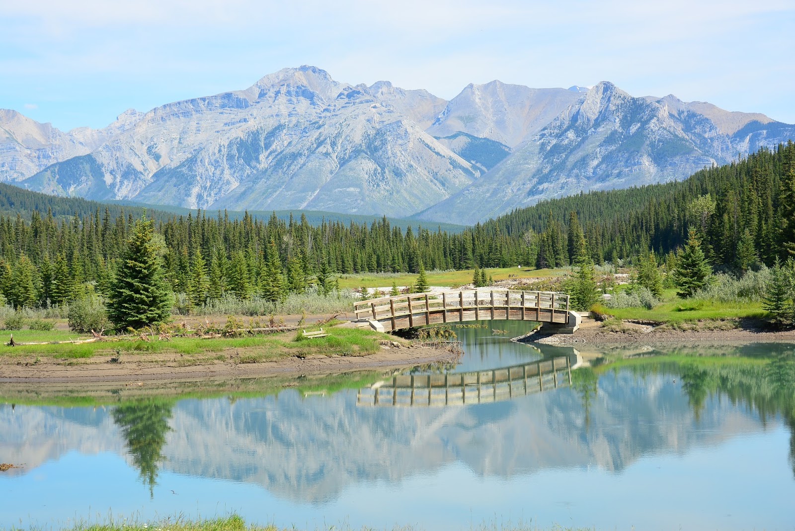
We took the old highway to Calgary and followed a beautiful River which eventually became the Ghost Reservoir which was a beautiful water area for people to sail and canoe especially on hot days like today. The blue of the water was an aqua colour and beside the green of the grass in the neighbouring paddocks, it looked very inviting.
Unfortunately, we then hit the outskirts of Calgary. We knew the name of the hotel but we had no address, no phone number and no GPS. We made a few wrong turns but eventually we saw the airport control tower and we headed that way. Then Neil remembered it was somewhere near the golf course so we circled that and while we were sitting at traffic lights trying to work out the next step, Neil saw the Port of Call sign on a building and, after a sudden change of 2 lanes, we arrived at our destination……..don’t ask me how???

Tomorrow we fly to Seattle (International flight: Canada to USA) and the following day we start the long flights home. We hope you have enjoyed our stories as much as we have enjoyed being here.

Hope to see you some time soon back home in Australia.

Tuesday 13 August 2013

Day 21 Jasper

Jasper is a pretty town with more houses than motels so the character of the town has been well preserved. There are many Bed and Breakfast forms of accommodation. Ours was very comfortable and spacious and we thought we would take out our rubbish to save work for the owner. Neil went to the bins but they were only for recyclables. Due to previous history of bear activity, all rubbish is put in bear proof industrial bins placed regularly along streets in residential areas.
On the way to Lake Maligne we saw
·         A caribou beside the road
·         Medicine Lake which has water levels which vary by up to 20 metres during the year. By October, the water in the lake has disappeared because the base is limestone with cracks and caves in it due to the uplift which happened in the area. By the end of August, the inflow is less than the drainage into the limestone caves so the water vanishes.
·         Explanations about the abundance of Rocky Mountain bighorn sheep on the slopes and the frequency of rock slides due to the vertical positioning of the sedimentary rocks on the slopes.
·         2 young caribou taking a long walk on the main road. One even licked the bus in front of us. They were still on the road when we returned from Lake Maligne
·         Rapids in the stream beside the road.
Maligne Lake is 28 kms long and up to 96 metres deep. It was formed by lateral moraine deposited by the Maligne Glacier. The moraine blocked the Maligne River and the lake formed. It is a busy place for locals and tourists in Summer with boat cruises (some to mystery island) and canoe hire. We moved on to Maligne Canyon and were surprised to meet up with the 4 New Zealanders we met during our tour of Alaska. We were  going opposite ways but we had time for a brief chat.
Closer to the town of Jasper there are many lakes which are also beautiful and used by locals for swimming, fishing and canoeing but the main hobby seems to be hiking in the woods around the lake. I hope they all wear their bear repellent and take their bear whistles.
·         Lake Annette has beautiful clear turquoise water
·         The lake in front of Fairmont Jasper Lodge is only for guests of the Lodge but it was beautiful with a mirror reflection of the nearby trees and mountains. The guests could also play golf on the course of the #1 golf resort in Canada. They could also ride horses. It was an impressive resort.
·         Patricia Lake is another pretty green lake but it is famous for its role in the Hobbakuk project which was backed by Winston Churchill. In 1942 they built a 1 in 50 scale of an aircraft carrier in wood and ice. Unfortunately the ice melted and the boat sank. It was one of the WW2 time projects carried out in the area.
·         Pyramid Lake is the biggest of the lakes near the township of Jasper but it is less than half the size of Medicine Lake.
We also saw a dog park. The fences were about 2 metres high to safeguard the dogs and their owners from the local bears. A trans Canada train went through the rail crossing and not only was it incredible long but the containers on the flat beds were stacked 2 high on most of them. We weren’t surprised when the end of the train appeared and it was another engine rather than a caboose.
Tomorrow we will cover about 400 kms on our way back to Calgary so maybe it will be an early start.

Day 20 Lake Louise to Jasper via the Icefield Parkway

We returned to Lake Louise at 8.30 am to see it with the morning sun on the water, the mountain slopes and the ice strips on Victoria Glacier. Our timing was good because the crowds were just starting to arrive as we left. Nearby Moraine Lake was discovered in 1894 and it holds beautiful reflections of the 10 peaks in its background. The valley is called the Valley of the Ten Peaks and it appears on the Canadian $10 note. Many moraines from glaciers on the mountain slope towards the icy water and there is an accumulation of logs at the end of the lake as it flows into a small creek. We drove along the Icefields Parkway which runs between the huge Canadian Rockies and fir tree forests. Some areas have avalanche warning signs so driving in winter could be exciting. So would Mosquito Creek be in summer you would think but it was full of RVs and hikers. They must have packed bear and mosquito repellent.
The mountains around us still had the remains of last year’s as thick ice in the cirques high up on the mountain slopes. Even after most of the heat of summer is over, the ice was at least 100 metres deep at the edge of the cirques. Around the corner from the majestic Crowfoot Glacier, we came across Bow Lake with its icy blue water contrasting the browns of the moraines and the greys of the peaks around it. Bow Lake is the source of Bow River which flows through Banff and Calgary. It is surrounded by Crowfoot Mtn, Mt Thompson and Bow Glacier.
Bow Summit is the highest point on the Parkway at 2068 metres and a short detour led us to Peyto Lake which was named after one of the first game wardens in the park. The water in the lake is bright blue and the wide view of Mistaya Valley is awesome. We followed the Parkway down into the valley and stopped at Waterfowl Lakes which are found at the foot of Mt  Chephren (3000 metres), a dark pyramid shaped mountain which overlooks the lakes.
After lunch at Saskatchewan Crossing Junction, we headed north beside the Saskatchewan River and pulled up at the side of the road for what we thought was the weeping wall. Neil had his camera out the window and it was like magic. Within minutes about 4 cars pulled up on either side of the highway hoping to see an animal. We left them to it and went further down the road still looking for animals on a huge plain area which the river probably uses for overflow when the glacial ice melts in Spring.
As we climbed to the next summit, we stopped for a photo opportunity where the mountains in front of us showed the results of both glacial erosion and tectonic activity. The rock eroded from the tops of the mountains had been deposited on the lower slopes as terminal moraine when the glacier melted while the sedimentary layers in the rock which had once been horizontal had been pushed up at angles. The scene also included Bridal Veil Waterfall on one side of the road and we could see the road we had just driven on down below alongside the river.
We continued past the lookout for Nigel Creek Canyon and headed for Mt Athabasca. We were surprised to see people walking into the forest at Parker Ridge despite the large sign warning of the danger of unexploded warheads (from WW2 bombing practice). We entered Jasper National Park and scanned the grassy lowlands for bears to no avail but the Icefields Visitor Centre was opposite the Athabasca Glacier so we thought we would book in to do the Columbia Icefields Tour on Wednesday on our way back to Banff. We climbed the 6 flights of stairs into the main building (luckily there were rest platforms every six steps). Suddenly, I saw Neil waving to me and we joined the line for the next tour. In a way we were happy because there was no wait and the skies were blue but we were dressed in Tshirts and we had left our coats in the car.
We took a bus to the transfer station where we boarded the Ice Explorer. The sign inside the explorer said  “this excursion involves steep inclines, rough roads, sideways movements and sudden stops”. The grade of the slope we went down over the lateral moraine left by the glacier was 32% so the 6 wheel drive rubber wheeled vehicle was almost vertical as we nosed down the slope carefully. At the bottom of the slope we went through glacial runoff to clean the tyres so that no dirt or rocks were left on the glacier surface. Then we started the bouncy ride up the side of the ice. The ice surface was dirty in places due to wind borne substances depositing on the ice. It also speeds up the melting process. We alighted from the Ice Explorer just below the main ice flow from the cirque basin and walked on the ice for 30 minutes. The ice and the run off water looked blue. That is caused by the compacting snow squeezing out air bubbles and reflecting blue rather than white. After studying glacial activity for years at high school and university, it was amazing for me to stand so close to the source of the Athabasca Glacier and hear the drivers talk about the structures which I had drawn diagrams of, having never seen the real thing!!! It is a pity it is retreating most years but there is some hope because some years it is longer than in previous ones.
As we set off for Jasper again at 4.50pm (a little later than we had planned but we were very happy with the Ice Explorer trip), we were caught in a road works hold up on a tight curved section of the mountain road. When it was our turn to use the one lane which was open, we saw that the edge of the cliff was the site of the new Sky Walk which will open next year. The glass bottomed structure was already in place but they were still working. A backhoe driver was in his machine on the edge of the cliff and digging out dirt, the consequences of which don’t bear thinking about. Maybe the machine was tied to something but it didn’t look like it.
We passed the Stutfield Glacier and were just thinking what a fantastic day we had had when we saw a few cars parked at the side of the road so we stopped and there was a big brown bear chewing leaves from a bush only 50 metres from the side of the road. Then he walked out onto the grass area before he went for a swim. He looked as though he was an adult dark brown bear. He was by himself as far as we could see. It was amazing to be able to stand and watch such a predator in his natural environment. What a day!!!!!

Monday 12 August 2013

Day 19 Calgary to Lake Louise

Our hire car is a Toyota Matrix with only 20,000 kilometres on the clock. With the back seat folded down there is plenty of room for our suitcases and hand luggage and there is a surprising amount of leg room in the front. We drove through some of the planned communities in Calgary before we took the 16th Avenue Nth/Banff exit heading towards the Trans-Canada Highway. The scenery was a very fresh green colour and the farm animals seemed to be flourishing in their paddocks. We saw cows, horses and a Wild West Event Centre. There were hay bales rolled up in preparation for winter and some unusual signs beside the road (highway). These signs appeared at various stages of our trip today. Most were on the sides of highways:
·         Watch out for deer crossing the road
·         Watch for pedestrians on highway
·         Cows crossing road
·         Logging trucks
·         Important intersection ahead
·         Warning bear in area
·         Slippery when snow covered
·         Boating Warning: Cold water and sudden high winds may be dangerous: Use  extreme caution
·         Attention: Elk crossing next 2 kms
·         Caution: Wildlife on highway ahead
·         You are now in Avalanche Country
·         Attention : wildlife crossing : Deer, Bear, fox
Most of the day the roads were lined with beautiful spruce forests and the horizons were dominated by huge imposing rock formations in which slopes had been carved out due to glacial action in the past and present. There were some snow tipped mountains but the main colour was grey as the strongest rocks stood proud to show they had beaten Mother Nature so far. The highways had much fewer trucks on them than our ones do but there were lots of grey nomads in huge winnebagos (RVs) ; some with cars attached and some with boats attached either above or behind.
Our first stop was at Kananaskis Village which is mainly a ski resort . It was used as the meeting place for the G8 summit in 2002 and I’m sure the delegates would have taken advantage of the bear repellent  and bear mints being sold in the general store. I wonder how the manufacturers did the testing on those products. Imagine the early stages when they were only 50 % effective. Maybe only every second person was attacked!!! Anyway, the centre was being renovated and, given that it is in a valley under the ski slopes, perhaps the renovations were set back by the April floods. There were some funny T shirts there eg car towing a caravan=canned meat for bears OR people riding pushbikes =fast food for bears OR meals on wheels ( and we saw lots of meals on wheels on both sides of the highways).
Then we looked at Barrier Lake with its beautiful blue water. It is obviously popular with the locals because there were people boating and kayaking on the water and joining nearby hiking groups. The Three Sisters refers to three taller rock formations here (similar concept to those Blue Mtns) but the bases are connected and the peaks are much higher. On the way to Banff, we drove through Canmore. There were lots of ski lodges and the main street was full of leisurely Sunday shoppers/coffee drinkers/ dog walkers. There was a Sunday market and an “Art in the Park” event. It was a traffic jam but later we saw that there were suburban shopping centres and life seemed much more relaxed in those areas.

We drove out to join the main highway again but very soon we were part of the highway car park. The highway goes through Banff National Park so everyone has to purchase a national park pass. Four lanes went towards toll booths like we used to have on the gateway bridge and 2 lanes were free for the few people who already had the passes. We bought a 4 day pass ($75) and were soon travelling again. We stopped at the Cascade pools to see the icy blue water, family picnic areas, Banff legacy trails and the reflection of the mountains in the water. The fir tree lined drive continued to Lake Minnewanka, which is a deep lake formed in a canyon. Its surroundings form an important habitat for bears which eat the buffalo berries in preparation for the long winter.
We battled the nose to tail traffic jam in Banff and eventually had subway chicken and salad for lunch. It was so good to have some fresh salad. When we left the subway shop, we met a fellow who was waiting with his dog outside the shop. It looked like a huge version of milkshake. It had the same colourings and the same head (in a big form) but it was an Italian Mastiff weighing 130kgs. It has to be with people and uses its head to push in to wherever he wants to go eg the shower. Obviously the wife is very tolerant because the dog sleeps in bed between them!!!
Bow Valley Parkway is the scenic route into Banff and we were hoping to see a bear or two. As the miles went by I was beginning to think that the advertisement in which you see the bear in the stream holding the freshly caught salmon was a con job but then we decided that the bears in this area are probably too full to fish with all the” meals on wheels” available. Cyclists were everywhere and they firmly believe that they are very important as far as road usage is concerned.
At Johnston Canyon, we had a fantastic view of Castle Mt and later Castle Cliffs. There have been many famous paintings done of this area with all the various shades in the rocks inspiring both young and older artist to put brush to canvas. The road we were on was partly built by people who lived here but were interned in Castle Internment Camp in WW1. People of Austrian, Hungarian and German background were imprisoned here in 1915 and they were put to work building roads in the national park and the main road to Lake Louise.
Just before we arrived in Lake Louise (with thousands of people from all over the world), we drove along a section of straight road with very, very tall fir trees which seemed to almost meet in the distance and the only thing stopping them from touching was a mountain with a light, puffy cloud above it. The view was stunning (see Neil’s photos). Before we checked in to our lodge we went down towards the lake but there was no-where to park. We asked the manager about it and he said it is always like that but that many of the day trippers go home after 6pm so we went later and the crowds were lighter. We are staying in Deer Lodge (next to Chateau Lake Louise) but the only way to the Lake is via a walkway. Anyway it is spectacular. The summer waters are icy blue but the colour changes to bright blue in Spring and of course it is frozen in winter so it seems that the view would be different every time you come to Lake Louise.
Tomorrow we head to Jasper and, no doubt, more fantastic scenery.

Sunday 11 August 2013

Day 18 Calgary

After studying some options of what to see in Calgary, we decided to go to the Heritage theme park. It was on the opposite side of town but we have experience in locating sites in faraway cities so we started on our journey. We took the shuttle to the airport, the 300 bus to the city, the light rail through the centre of town to a changeover station, another light rail to Heritage stop and a shuttle bus to the park. We saw both old and new parts of the city and the total cost for the return trip was $8.50 each. The transport system is very easy to use even for those who have trouble walking, like me.
Heritage Park is the largest living history experience in Canada. It is a real –life, interactive story of life in western Canada from the 1860s to the 1950s. It was built on land which was originally owned by a pioneer farmer, Sam Livingston. He settled here in 1877 and his homestead is still part of the park.  We walked down a street which was representative of town streets from the time period. We saw the inside of old houses with people dressed in period costumes who told us about life in those times. We were amazed when we entered the classroom because the wooden desks and inkwells were exactly the same as the ones we had used until Grade 7 ourselves (1965/66). There were slates like the ones we had used in Infants School and the wall maps and hand writing guides were very similar as well.
There were dray rides with Clydesdales struggling in the heat to pull the people around. There were more horses in the paddocks belonging to the farms and there were shady parks with bench seats for parents to sit on to watch their children play. It was a great place for families. There were log cottages and wooden ones which housed the bakery, the post office, a printing establishment and the 3 railroad stations. We rode the railroad and marvelled at the age of the train: 120 years old carriages, 129 year old carriage and a 1944 steam engine.  The carriages had been part of the Canadian Pacific Railway. We also went on the paddle steamer (S.S. Moyie) for a trip around Glenmore Reservoir which is the water supply for Calgary. We saw dragon boat races and lots of sailing boats and kayaks on the water. Our last stop was at Gasoline Alley which housed the private collection of vintage cars of a local identity. There were old fords, model T ford, Reo speed wagon, a marmon, a buick, an oldsmobile, very early 1910-1920 american cars, original garage signs and a wide range of gas pumps all beautifully restored.
Next year is the 50th anniversary of the park’s opening but they had lots of celebrations there today. There were 6 weddings being held there today so as we left there were bridal parties and guests arriving. In April this year there were massive floods in Calgary and most of the CBD went under so the wedding venues cancelled all bookings from April until November this year and lots of brides had to find new wedding venues. They were being married in the church, the printing house,  the homestead and gasoline alley today. The last bride was going to walk down the aisle in between old petrol bowsers and beautiful vintage cars…at least it would be an unusual wedding.
As we were leaving, Neil talked to an MX5 driver who was parked at the entrance waiting for his wife to appear. He was the one and only owner of his 1996 NA blue MX5. He bought it new when he retired as a toy to enjoy but he is disappointed that none of his sons or grandchildren is interested in it because it is a manual and they want automatics. He has refused offers to sell it. It has done 115,000 kms and it is still on its original tyres. It is only driven 4 months each year because of the cold weather. Neil was wearing his 2010 NatMeet shirt so the fellow was very impressed.
Tomorrow we pick up a hire car and head towards Banff, Jasper and Lake Louise. Bye for now.

Saturday 10 August 2013

Day 16 and 17 Denali to Calgary via Anchorage and Seattle

DAY 16
After a leisurely start to the day, we went to the visitor Centre at Denali to see life-size replicas of moose, dall sheep, eagles and some of the smaller critters in the park and we read interesting comments about the way in which the animals co-exist or form part of the wilderness food chain. Then we boarded our first class carriage of the Alaska Railroad and we were amazed that we had the same seats we had had 2 days before. We saw a moose just after we left the station on the way to Anchorage and then we looked down on some of the lodges we had seen during our stay in the park.
We followed the Nenana River as the tracks fitted snugly around the base of the backs of some of the mountains which surround the national park wilderness. Panorama Mountain (5800 ft) had some grren colouring in its rocks and it has a limestone mine at its base. Suddenly the train stopped and an engineer got out of the train to manually flip the switch. Apparently it is safer to do it manually than to rely on power supplies in the area. At Summit (2363 ft), we met the partner train coming up from Anchorage. The 2 trains pulled up side by side so that some of the crew could swap trains. We were in the middle of no-where (not at a station) on an elevated plain and the people just jumped on the track and over to the opposite train. Luckily no “baddies” rode up on horseback to rob us but maybe that is why the carriages are cashless these days.
Broad Pass is the watershed divide of the trip. On the Denali side of Broad Pass the waters of the streams flow north but on the Anchorage side they flow south. We saw a family of beautiful swans there. They have been in the area for about 2 years and they measure about 6ft from head to tail. Beavers live in Honolulu which is the halfway point between Fairbanks and Anchorage. We saw many beaver dams before we headed into Hurricane Gulch where there was a 296 ft drop to the creek below. After we safely crossed the creek on a scenic bridge, we were told that workmen are currently working on the foundations of the bridge to make it stronger.
In the distance (46 miles away), we could see the base of Mt McKinley but the top was covered in clouds so it was good that we had such a clear day the day before.  The Indian River ran beside us with clear water and we tried to see the salmon swimming upstream to spawn (The red salmon spawns in lakes). By contrast, The Susitna River which appeared beside us was dirty in colour due to glacial silt being suspended in the water. Yet all 5 types of salmon (chum, sokkai, king, silver and pink) swim in the 300 mile long river.
The town of Curry used to be a bustling rest place for travellers before the railroad was built. The hotel had a swimming pool and a tennis court which was luxurious at the time but it was mysteriously burnt down in 1957 and never rebuilt. Now it is almost a ghost town but there was a little caboose surrounded by vegetation on an old siding and we saw some native Athabasca Indians using a fish wheel in the river nearby. Then we saw a golden eagle sitting on a rock in the middle of the river. Perhaps he was looking for fish and chips for dinner.
Talkeetna is the base station for climbers who want to climb Mt McKinley. Many climbers believe it is harder to climb Mt Mckinley than it is to climb Mt Everest. It is mainly because it is climbed without oxygen and the temperatures they have to endure climbing a mountain which is close to the arctic circle are much more challenging than climbing mountains near the equator. It is not as high as Everest but the conditions are much harder. More than 90 people have died climbing Mt McKinley. I don’t think that I will put it on the bucket list. However, as a town, Talkeetna is famous for its salmon fishing, rafting and boating excursions.
Although 75% of the Alaskan population live between Anchorage and Fairbanks, the capital Of Alaska is Juneau. They tried to have the capital moved to a town on this railroad, Willow, so that it was more accessible by the majority of the people but it was rejected due to the cost involved in moving everything there. Willow is a small town of only 2000 people and it is famous as the starting point of the Iditarod dog sled race. By 8pm we had arrived in Anchorage and we lined up with the baggage tags to collect our luggage from the bag carriage. The scene was total chaos. Fork lift drivers carried big containers of bags over to the area in which we were standing (outside the station near the taxi rank). Then workers took the bags from the containers and put them in front of the travellers (about 200 people) and we had to find our bags along a 25 metre line. Anyone could take anything. No-one checked baggage tags. Then there was a rush for the taxis. We were lucky in that we found our bags quickly and we joined a taxi “area” ( no-one knew which end of the line was the head of it) and arrived at the airport in good time.
DAY 17
Day 17 was really an extension of Day 16. We waited until just after midnight to board our flight to Seattle. A Chinese family sat down opposite us. There were 9 people travelling together ( Grandma, Mum, Dad, 2 sons, 2 primary school-age daughters, one toddler and one baby. ) In the 3 hours we sat with them, Mum and Grandma chatted without a break and the 2 little ones were the responsibility of the three older children. Neil entertained the children for a while by making his camera disappear by magic as he removed lenses and put it in his bag and then the camera which appeared was the little red one. All 6 kids were spellbound watching the magic.  After that the toddler took off and the bigger kids spent their time carrying the baby and following the toddler to various areas of the waiting area. Mum and Grandma just kept talking……Then when boarding was called for our flight, Mum carried the baby in her arms as though she was the most precious little thing and the other 5 children picked up their bags and boarded the plane.
The flight to Seattle was about 4 and a half hours and we managed to get a smidgen of sleep. We went from shuttle to shuttle via very clearly marked signs through the Seatac airport and found the gate we needed for the next flight to Calgary. We had a 4 hour wait and it was difficult to stay awake but a toddler beside us kept us interested as he tested his parents as they went through a variety of behaviour management techniques to get the little boy to stop running and yelling because they wanted to get some sleep. As you would expect, the boy, Sammy won on all counts but the parents weren’t upset they just grinned.
When we hadn’t been called to board by the 9am timeline, Neil went for a walk and found that the airline had changed the gate for our flight in the past 4 hours. Luckily he did because some people we already on the plane and we had to hurry to get on the plane. They wheeled me out in a wheelchair because I wasn’t moving fast enough. Access to the plane was via a “few” steps but we made it and eventually arrived in Calgary. Our motel is great. Neil selected it because there was a good deal and it was close to the airport. However, that was in January and now they are doing works on a new super runway, so the shuttle trip from the airport to the hotel was 30 minutes (without traffic).  As soon as arrived in our room we crashed for 2 hours and I think we will sleep well again tonight.

Thursday 8 August 2013

Day 15 Denali National Park Tour

We spent a fabulous day today in Denali National Park. Our driver, Jim, drove us 92 miles into the park for lunch and then patiently stopped many times along the route to verify sightings of all kinds of wildlife. We awoke to a fine morning and stepped onto the bus at 6am. Our 14 hour wildlife adventure was underway. The weather in the park often involves some level of cloudiness because 2 weather systems compete with each other in trying to cross the mountains (they are incredible) in the park. Today there were a few wispy clouds around the top of Mt McKinley on our way in but we could see its peak on the return trip after lunch.
Private vehicles are only allowed to go 15 miles into the park so everyone has to take either a park bus or a charter bus to experience the scenery and the wildlife. This system helps reduce damage to the environment and accidents given that the dirt roads wind around the cliffs on one side of the park with razorback turns and very little space for buses to pass side by side in opposite directions.

Luckily all the drivers are tested on park roads and they do practice sessions involving possible difficult scenarios before they are allowed to drive in the park. Most of the time, there was a sheer drop on one side of the bus and very little warning about buses coming in the opposite direction. The roads have to be repaired every year after the winter snow melts so it is fresh dirt overhanging sheer drops. Our driver was fantastic.
Before we met Ranger “Happy  Harry” Zimmerman and entered the park, we saw our first critter; a 4 year old female moose who would begin the breeding cycle this season (Autumn). She will have 1 offspring the first year and 2 offspring every year after that for about 25 years. Wow!!! There are about 800 moose in the park.Harry welcomed us to the park and reminded us that “no wildlife is allowed in the bus”.  If anyone saw an animal, he/she had to call out “Stop” so that we could all see it and get good photos.
 The Savage River valley which we followed was one which had been carved out by a glacier which was fed by many smaller ones which flowed from the tops of huge mountains on either side of the valley. The mountains were spectacular in their shapes and colours. They ranged from sharp tipped ones with arretes and cirques adding to the angular shapes to rounded areas of Tundra covered in low bushes and grass. The colours ranged from black, grey and cream to brown, rust, yellow and green. Please look at Neil’s photos to experience the wonder of the landscapes. They almost looked as though they were drawn on a canvas. One impressive view was of Mt McKinley, the tallest mountain in Alaska at 20,000 feet. It appears above a group of snow-capped mountains and that group is surrounded by grey and black stern-faced guardians.
We saw many animals such as:
·         20 caribou: from babies to large males with huge antlers
·         5 of the 800 moose in the park
·         7 tarmagan which are members of the grouse family. There raced along beside the bus and luckily did not decide to cross the road
·         3 of the 118 pairs of Golden Eagles which live in the 6 million acre park. They have a big wing span and glide around surveying the activity in the park
·         3 grizzly bears (same as brown bears). The first one was a dot high on a mountain side but then we saw one in the river flat area digging for food and one at eye level on a slope.
·         4 squirrels rushed across the road in front of the bus
·         We saw 3 dall sheep (mountain goats with the curved horns) on the side of the road munching on green leaves. There used to be lots of these in the park but once the road was put through the park, the sheep thought it would be a good idea to use the roads rather than work hard to walk through the tundra vegetation. However, the foxes then realised it was easy to lie in wait for the sheep and pounce on them as they walked without any cover. Therefore, the number of sheep is declining.
It was a fantastic place to see both for the geographical landforms and the wildlife we saw. It is so hard to say which part of the last 2 weeks was the best. Every place we visited had new, spectacular and interesting aspects which we loved. Tomorrow we travel first class in the dome train again on our way to Anchorage arriving at 8.30pmand then we catch planes to Seattle and then Calgary so we won’t actually be in a hotel tomorrow so I’ll catch you up the next night. All the best from Alaska.

Day 14 Fairbanks to Denali

The skies were a little cloudy this morning but by this afternoon they were mainly blue again. We have been very lucky with the weather. We checked in at the Alaska Railroad office for our first class seats to Denali. We were in the first carriage on the top deck with a glass ceiling and huge windows so that the view everywhere was fantastic. With free tea, coffee and sodas as well as the scenery, the next 130 miles to Denali were looking good. We started on a loop line for the train to turn around and had a great view of the types of carriages the train could pull. There were hoppers full of coal, container carriages, box crates on flat cars, tanker cars carrying oil from the Bering Sea and flat cars carrying up to 3 semitrailers at a time. The Fairbanks rail yards covered 440 acres and they were one terminal of the Fairbanks to Anchorage train.
As the two 4,300 horse power locomotives pulling the train started on the main route, we passed Fairbanks University which services about 5,500 students and at which there is a lot of research done in fields such as cold climate living, aurora borealis activity and experimental agricultural techniques. Fairbanks has 98 long days of summer in which sometimes the sun shines for 20 hours a day so the vegetables are sweeter than elsewhere due to the extra rays of sunlight.
Winter is a different story with normal winter days recording -40 degrees F. Schools are closed at -50 and the university closes at -55 degrees. In winter Moose Mountain gets only about 6 ft of snow but there are ski lifts which operate from November to Easter each year so that skiing is enjoyed.
We had spruce and tamarak trees on both sides of the train. They were mainly green but there were some small patches of yellow starting to show. Therefore the autumn colours of red, yellow and brown were just around the corner. Sometimes autumn is only a few weeks in length so winter is not far away. Hunting seasons for moose and caribou start in September.
After looking at some hot house farming areas we were impressed with the Alaska Native Memorial Bridge on which the George Parks Highway was built. It connects Anchorage and Fairbanks. They started building it in 1959 and finished it in 1971. From Nenana you can see Mt McKinley, the tallest mountain in Alaska, and there were many good viewing points of it along the route.
The longest bridge on the track is the Meares Memorial Bridge which is 702 ft long and the train slowed to tackle the 1% grade in the track. At Nenana, they have a competition like they have at Dawson City. For a $2.50 bet, people try to guess when the river will start to thaw. This year the winner took home $300,000 so it is a good prize and everyone rushes to the landing when they hear the bell ringing. 85% of Alaska has permafrost (permanently frozen ground). Above the permafrost, there is land which seasonally freezes and defrosts. Small trees grow where the top level is shallow and the taller trees have deeper roots but sometimes they end up with a “drunken forest” when the freezing patterns differ and the trees grow at different angles as well as different heights.
We passed Clear Air Force Station which was built as a ballistic missile spotting station after the Russians built the Sputnik in 1959. It cost more than 3 billion dollars to set up. In 1981 it changed to a radar system and in 2011 the radar capabilities allowed 24 hour surveillance. The town of Healy has only 39 people and their telephone service only began in 2001. What did they do without phones?
We passed the Usibelli Coal field which is the only coal field currently being mined in Alaska. The coal there is relatively young(only 20-30 million years old) and produces cleaner energy . The company was also proactive in reclaiming the land after mining it even before it was compulsory for mining companies to do so.
Suddenly we started the slow downward drop into Healy Canyon. The views were fantastic with the curved railway line allowing us to see all the levels the river had gouged out of the original glacial valley and the result was a V shaped gorge with sheer rock sides and a fast flowing stream with rapids for the locals and the tourists to enjoy. The water is usually about 32 degrees F so rafters wear suits to keep warm. The water that is in the river now was ice about 10 hours ago.
We passed under Windy Bridge, the third highest road bridge in Alaska, where the wind is so strong that it can blow cars and trailers from one lane to another. We arrived at Denali and we pleased to see our shuttle bus was there to meet us. After lunch we took the shuttle to downtown Denali (one street) and looked around. We meet a young lady who was about 23 yrs old and she arrived by pushbike. We asked her where she had come from and she replied, “Argentina”. She was from Germany and planned to ride the pushbike all the way to Deadhorse ( at the top of Alaska as the crow flies). What a journey!! She has taken two and a half years to get this far and is hoping to write a book about her journey. I hope it is in English!!
Tomorrow we are going on a nine hour bus ride to search for animals like bears and moose. I’ll let you know how we went.

Monday 5 August 2013

Day 13 Fairbanks, Chena River Boat Cruise and North Pole

We took the shuttle to the SS Discovery, a sternwheeler (paddle boat) which has been run by the same family for 3 generations. The grandson of John and Mary Binkley was the Captain of the boat but many of the descendants work either on the boat or in the restaurants and gift shops that form part of the Discovery experience. We met Captain Ryan Binkley as we boarded the sternwheeler and the staff from the shops came out to wave us goodbye. There are 3 million lakes in Alaska so many planes are sea planes and we watched a demonstration of the usefulness of a sea plane which can take off and land easily in rivers. Many are used by bush pilots who go to the aid of people in need in remote areas. 1 in 60 Alaskans is licenced to fly.
We were paddling down the Chena River which is famous because:
·         President and Mrs Regan stayed there in the Binkley’s home while waiting for the Pope to arrive
·         Trailbreaker Kennels are on the banks of the river. They were started by Susan Butcher who won the famous Iditarod dog race 4 times with the dogs she bred and trained. The race is a 1000 mile sled race and is famous around the world. Susan died of breast cancer in 2006 but her legacy continues with new trainers in the kennels. We saw a sled demonstration and later we could pat the dogs. One was a very close relation of our Maxie. He just wanted to sit and be patted on the head and around the neck. The dog’s name was Madeye because he had 1 brown eye and one blue and brown eye. He has run the Yukon Quest and the Iditarod races so he is used to train younger dogs
·         There is a use for sled dogs in Fairbanks because, for 33 weeks of the year, the river is frozen and it becomes a road and sled dog track for transport.
·         The Athabascan Indians have lived in this area for 10,000 years and we saw examples of their subsistence lifestyle and current young members of the tribe explained how the lifestyles changed once the white men came during the gold rushes. We saw the tools they used, the clothes they wore, examples of pelts, 4 caribou/reindeers (reindeers are domesticated caribou) which were grazing in a pen, a stuffed moose and some bear skins. There are about 780,000 caribou in Alaska and they migrate with the seasons.

·         Three species of salmon spawn in the Chena River. The females lay up to 1500 eggs, the males fertilise the eggs and then the males die. Pretty drastic but there must be lots to continue the breeding process because they use a fish wheel to catch lots of fish at once as it is “more efficient” than pole fishing.
After the cruise, we went by van to a nearby town called “North Pole”. Yes, that is the name of the town. There is a huge Santa Clause statue which must look fantastic when it is covered in snow, a Santa Clause Lane, a Santa’s workshop and some huge candy canes on the side of the road. We went inside the work shop and Neil sat on Santa’s chair to have his photo taken. Inside the work shop, there were Christmas lights and decorations everywhere. It was amazing. Santa’s sleigh was outside and the reindeer were grazing in a paddock beside the work shop. However it was about 160 miles to the Arctic Circle so I think the one in Finland must be closer to where the big man lives.
Tomorrow we take the dome train to Denali National Park. We should see some animals on the way and even more the next day when we spend a whole day touring the park.

Day 12 Dawson City to Fairbanks via Top of the World highway

After a relaxing morning in Dawson City, during which Neil went to the museum and returned with some interesting points:
·         According to the museum display, the Yukon River changed the direction of its flow as a result of advancing snow and ice which blocked the South and East flow of the river about 3 million years ago. As a result the Yukon carved out a route to the Bering Sea in the north. Perhaps this happened at the same time as the tectonic movements….
·         Neil saw more examples of the remains of Woolly Mammoths who roamed this area in the ice age because Dawson City was ice free then
·         Originally this area was populated by the First Nation people as part of their seasonal migration looking for fish, caribou, moose etc
·         1846 saw the arrival of the Hudson Bay Trading Company as they set up trading posts in the Yukon. They were forced out by the Chilcat 10 years later
·         Early miners used picks, shovels , gold pans and rocker boxes
·         When 30,000 people arrived in Dawson City after hearing about the gold strike in Bonanza Creek, Dawson City was the biggest city north of San Francisco
·         A competition is held each year to guess the exact time the ice in the river will break and the whole town goes down to the river to watch the start of the melt
We left Dawson City at 2.15 via a different route. We waited for the paddle steamer to pass and then drove on to the car ferry and crossed the Yukon River by ferry. Once the river freezes, an extra layer of water is put on the river to make the freeze stronger. Then cars, trucks and semi-trailers drive across the frozen river.
We passed through West Dawson and set off on the Top of the World Highway from which we could see the strong but silty Yukon River, Dawson City and the Klondike. It takes 10 miles for the 2 rivers to fully integrate but the land beside the river is very fertile. We gradually wound our way up to the top of the mountain ridges on the dirt road which stretched most of the way to Fairbanks. We climbed above the tree line (4,300ft) and drove to the border (USA and Canada) with mountains from one horizon to the other. The mountain tops were all grass covered and we saw a caribou watching us as we went through the border crossing at a place called Poker Creek (Elevation 4127 ft Population 2)
We swapped vans just after the border crossing and, after watching a whole herd of about 30 caribou walking and grazing on top of a mountain near us, we headed off to Chicken, Alaska. It was called Chicken because the miners could not spell the name the Indians called it. About 20 miles from Chicken the Top of the World Highway ends. It was built in the 1970s to connect 2 mining roads and make it possible to drive from Dawson City to Fairbanks on this scenic route. Suddenly we came across 3 caribou walking on the main road. They looked at us and kept walking. Then they turned around and were not impressed to see us still there. Two left the road and the biggest one then followed his friends so we could continue our journey. They have right of way so we just slowed down and followed.
In the town of Chicken people receive mail once per week by air. The town sign said 39 people and 1 old grump live in Chicken but 2 years ago the grump died. We stopped to get fuel and some drinks and then headed towards Tok for dinner. Its population in summer is 1200 but few businesses stay open in winter so the number is much small then. An unusual road sign beside the highway read: WILDFIRE AHEAD: DRIVE WITH CAUTION. There are about 70 fires burning somewhere in Alaska each day. We finished on the Alaskan Highway near Delta Junction and pulled up beside the Alaskan Oil Pipeline . It has survived an earthquake of 7.5 and goes for 800 miles.
We crossed the Tanana River which is very fast flowing and saw the Eielsen Air Force Base which is 23 miles from Fairbanks and the runway is long enough for moon launches to land if necessary.
Finally we arrived at our motel in Fairbanks at 12.10am. Bed sure looked good.

Saturday 3 August 2013

Day 11 Gold Bottom Tour in the Klondike

On another fine day, we decided we wouldn’t need our jackets either for warmth or rain protection. We walked a short distance to Westmark  Inn and joined some American retirees on holiday. Some had done the gold mine tour the day before and some would be joining us for a bit of prospecting. A bus and a van carrying 20 people in all set out for 3 hours of adventure. Our driver, James, is from Lake Watson, Yukon  but he lives on the mine site in Summer and can speak from first hand experience about the mining process.
James pointed out the site of the confluence of the clean Klondike river and the dirty Yukon river in front of Dawson City. The Klondike was dredged for 60 years until 1967 and the tailings from that period of gold mining still line the side of the main road. While it looks like huge mounds of disused rock, the Canadian Government has declared most of the area as a national monument to commemorate the gold rush era. Now the Klondike is a beautiful green colour while the Yukon picks up so much dirt in its long meanderings that it is a brown colour when the 2 rivers meet .
We left the main highway and turned into Hunter Creek Road on which there are 80 active mine sites and 190 mining claims. There are strict rules about the way water is returned to the creek after it is used in the mining process with most miners passing the water through 2 settling ponds before it goes back into the creek which then join the clean Klondike. Generally the claims stretch from the water of the creek to the mountain area behind it. There is an old mining shaft still there from the gold rush days. It was frozen in the permafrost so it has been stored in immaculate condition.
Goldbottom Mine is like most other claims in the area; they are worked by families. Most mines have only 2 or 3 people working them but there is one very large operation which employs about 15 men. At the Goldbottom site there were 5000 people living there during the peak of the gold rush but now there are only 7 people and 2 dogs there. The house in which the owner’s son, mother and the tour organisers live was built in 1907 and it has been continually lived in since that time. The original owner died in 1972 after making a fortune and travelling the world and he left the mine to his son, David.
The permafrost freezes things rather than fossilizing them so there are lots of bones in the material which is excavated. They have bones and ivory from woolly mammoths. It is legal to collect mammoth ivory because they are extinct. We held a piece of a mammoth’s tooth. It was big and heavy and looked a bit like white wood.
In order to stake a claim you need 2 posts to place on the site and then, within 10 days you have to get back to Dawson City with $10 to register the claim. Now that journey only takes 20 minutes but in the days of the gold rush it took days. That claim payment gives you 1 year to work the ground but every 12 months you need to complete $200 worth of infrastructure around the site to keep your licence.
The mining process involves water, gravity and agitation and the bigger picture is one of stripping, sluicing and clean up. They dig through to the permafrost with a claw bucket on an excavator  and use powerful water spouts to help loosen the permafrost so that they can remove all the black dirt to get to the gold which is just above the bedrock and below a gravel layer. They keep the gravel and the black dirt for the restoration of the land after mining is finished. They get about $3000 per week for the gold they retrieve from May to September and from that they pay wages and fix equipment so you can see that gold mining is not a way to become wealthy these days. However, they keep going because one day they may find a new rich layer of gold (and also the tours augment their incomes). In winter, even the water freezes so they can’t work the mine. Also you would need a dog sled team to get to the site over the snow and ice in winter. Apparently the population of Dawson City is about 5000 in summer and 1500 in winter as more than half the businesses close down for the winter months.
Now to the news you are all waiting for: Neil worked hard at panning for gold. He followed all the instructions and stood in the cold water to secure our future financially but…he didn’t find any gold!! Some people did come out of the water with specks of the mineral (less than a pin head in size) but I don’t think those treasures will make an difference to their future financial security either.
The day was not a disappointment though because we met a new friend. He was 13 months old; a cross between a german shepherd and a rotti and he thought it was great to talk with all the guests. His name was Zeus but he had a little red spot on his nose so he is sometimes called Rudolph. He seemed to know that Neil was an expert at playing tug-of-war with Milkshake because he pulled and pulled on his rope toy while we were listening to the guide. I threw the rope for him and he loved to play fetch. James said that they often see bears, moose and foxes in the area but when the dogs bark, the other animals tend to retreat so Zeus is a working dog as well.
We had a great morning and spent the afternoon walking through some of the unusual shops in town on our way back to the hotel. We found some used number plates from which Neil chose one for his collection. They were used ones and obviously the cars here have a rough time. One even had a bullet hole in it. Tomorrow we have a relaxing morning and then head off to Fairbanks which is very close to the Arctic Circle.